Caliraya Lake Overview
Caliraya Lake Overview
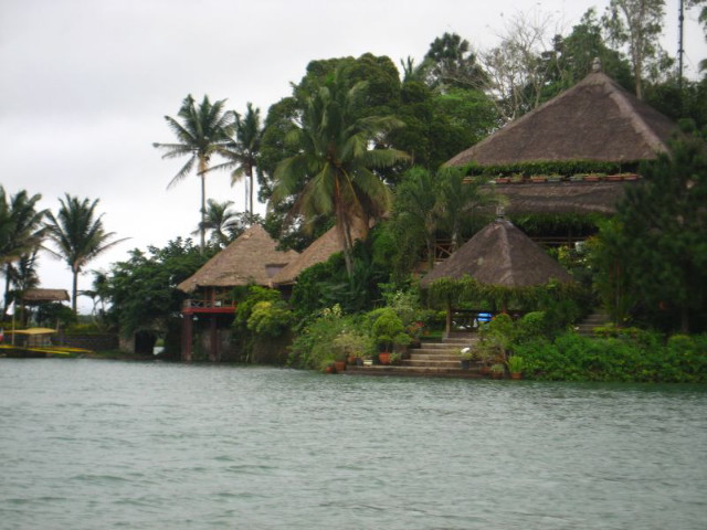
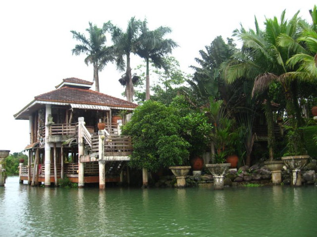
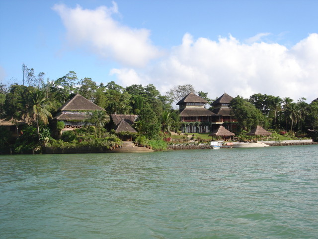
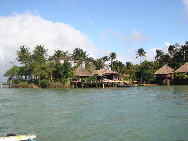
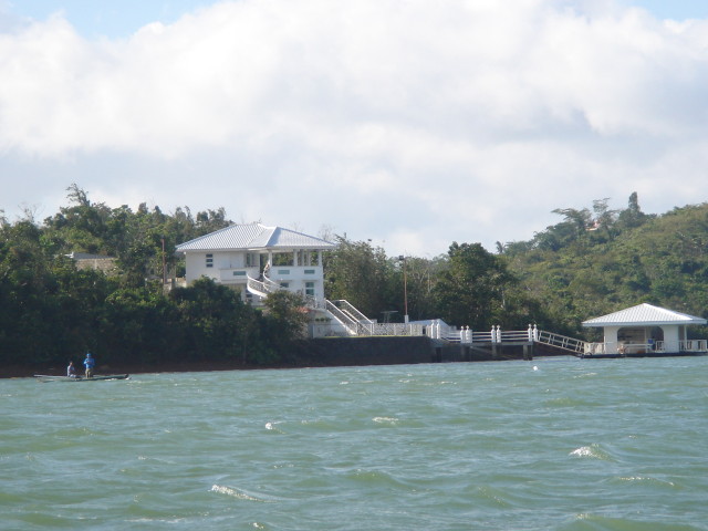
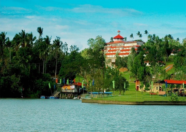
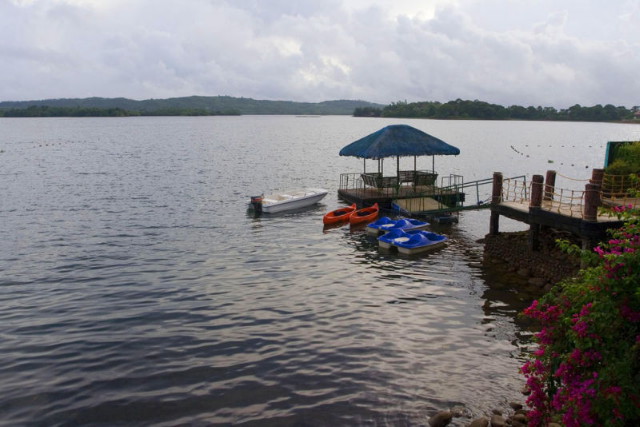
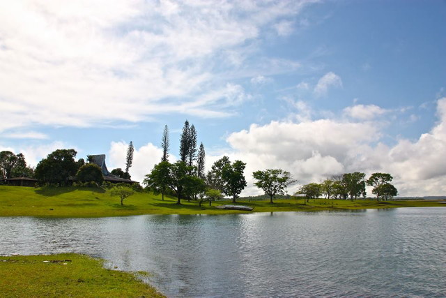
The Caliraya Lake – A wonderful, beautiful, and over-whelming man-made lake once served as a water reservoir many decades ago.
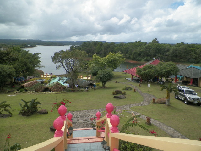
Nowadays, numbers of resorts are bloom along the exceptional lake, invites people to visit, have peace of mind, have fun, relaxed, and enjoy with your friends, family and love ones to escaped, even temporarily, the hectic and busy life at the city.
Profile of Laguna
Laguna, Resort Province of the Philippines, is a haven of fresh and pristine bodies of water such as hot springs, lakes, and waterfalls. Most notable is Pagsanjan Falls. It is found in Cavinti where Caliraya Lake is, starting from Pagsanjan town. Another is Caliraya Lake, which is located between Cavinti and Lumban. The strong mountain breeze that blows from the Sierra Madre Mountain Ranges and the distant Mount Banahaw makes the lake an ideal place for aqua sports like wind surfing, water skiing, sailing as well as game fishing. Laguna de Bay, Southeast Asia’s largest fresh water lake, stays pristine throughout the year due to regular rain showers.
Numerous hot springs abound in the province, including the famous Hidden Valley Springs which is located in a secluded part of Alaminos town. A trip to Dalitiwan River, located in Botocan, Majayjay, is an exciting adventure because the terrain is rugged, as mountain lands go, and the cool water or river gushes through the rocks and boulders along the watercourse in sweeping currents. The mystical Mount Makiling in Los Baños is an inactive volcano, with its height of about 1, 109 meters or 3, 637.52 feet above sea level.
Laguna is not only riched with natural wonders. It also plays an important role in the country’s history as the birthplace of Dr. Jose Rizal, the country’s national hero, whose infancy and early manhood were spent in the towns of Calamba and Biñan. A number of churches of Spanish-influenced architecture in intricate Romanesque and Baroque design, mostly restored to their original elegance, are also found in the province.
The province is one big showcase of Southern Tagalog craftsmanship. The town of Paete is famous for its woodcarvings, paper mache, and handmade paper products.Tree seedlings, sampaguita flowers, orchids, and exotic plants are big business. Cut flower farms are found mostly in towns of Calamba, Los Baños, and Bay. Sweet tropical fruits abound, such as the lanzones from Paete, pineapple from Calauan, chico, banana, mango, rambutan, and avocado. Add to these Laguna’s embroidered garments.
Jusi cloth made from banana fiber is painstakingly, albeit deftly, transformed into beautiful pieces of clothing worthy of being tailored into the Philippine national costume, the Barong Tagalog. Shoes made from abaca hemp is a growing industry in the town of Liliw.
Owing to its nearness to Manila, Laguna is presently becoming the center of economic activity in the Southern Tagalog Region and the CALABARZON area. Business in the area is bustling as shown by the presence of several industrial estates designed for handling large scale firms engaged in textile manufacturing, electronics, food processing, industrial machines, and car assembly.
Laguna is situated 30 kilometers south of Manila and has a total area of 175,973 hectares. Laguna is bounded on the north by the province of Rizal, on the east by the Sierra Madre Mountain Ranges, on the south by the Quezon province, on the west by Laguna de Bay, and the provinces of Batangas and Cavite. Laguna being part of the Southern Tagalog Region, approximately 99.22% of the population speak Tagalog. A minority of the population also speak Ilokano, Bicolano, and Waray. A significant portion of the working population can read and speak English and Filipino.
The Province of Laguna has a Total Land Area of about 175, 973 hectares and has a polpulation of 1, 965, 872 Million individuals as of year 2000. Its capital is the Town/Municipality of Santa Cruz. This province has two seasons namely, the Dry Season during the months of November up to April, and the Rainy Season during the months of May to October.
Laguna has 27 Municipalities namely: San Pedro, Biñan, Cabuyao, Los Baños, Bay, Calauan, Victoria, Liliw, Rizal, Alaminos, Nagcarlan, Pila, Pagsanjan, Lumban, Kalayaan, Paete, Pangil, Pakil, Siniloan, Famy, Mabitac, Santa Maria, Luisiana, Cavinti, Magdalena, Majayjay, and Santa Cruz. And the 3 Cities are the: San Pablo City (Chartered City), and the component cities which are the Calamba City and Santa Rosa City.
Major bus companies here in the city have its trip to the well developed roads to and from Metro Manila and within the CALABARZON (Cavite-Laguna-Batangas-Rizal-Quezon) on a regular basis. Bus terminals are located at Buendia and Taft Avenue and EDSA in Pasay City.
* Caliraya Lake Eastern route: In this route, you must take the Ortigas Avenue through the towns of Rizal and onward to the eastern towns of Laguna through the Laguna de Bay road network.
* Caliraya Lake Southern route: In this particular route, the South Expressway is the main artery, with exits at San Pedro, Biñan, Sta Rosa, Cabuyao and Calamba in Laguna.
* Caliraya Lake CALABARZON route: The highway system and well-developed road network of this region links the neighboring provinces with ease and convenience for tourism, trade and commerce.
Profile of Lumban Town
Lumban, Laguna
Name of Municipality: Lumban
Region: CALABARZON ( Region IV-A )
Province: Laguna
Country: Philippines
District: Fourth District of Laguna
Distance from Manila: 104 kilometers southeast of Manila
Barangays: 16 inhabited, 2 uninhabited
Income Class: 4th Class
Land Area: 96.8 square kilometers, the fourth largest in Laguna
Population: 25, 936 people ; 5, 456 households ( as of year 2000 )
Famous Landmark: Man-made Caliray Lake
Barangays close to Caliraya Lake
Lumban is politically subdivided into 16 inhabited barangays and 2 uninhabited barangays, arranged in alphabetical order.
Inhabited: Bagong Silang, Balimbingan, Balubad, Caliraya, Concepcion, Lewin, Maracta, Maytalang I, Maytalang II, Primera
Parang, Primera Pulo, Salac, Segunda Parang, Segunda Pulo, Santo Niño, Wawa.
Uninhabited: Binayuyo , Kulyon.
Lumban is one of Laguna Province’s oldest towns. It derived its name from a tree called “Lumbang”, then later on it they called it Lumban. It is where a beautiful man-made Caliraya Lake is located. The province’s capital town, Santa Cruz, as well as Cavinti and the famous Pagsanjan, were once part of Lumban.
Lumban is also known as the “Embroidery Capital of the Philippines”. Fine Jusi and Piña cloth are being embroidered by hands, finished product are worn by male as Barong Tagalog and Saya by Female, it is also being exported and worn by westerned people. Various products are also made using this type of cloth such as bags, wallets, and many more.
Profile of Cavinti Town where Caliraya Lake is located.
Cavinti, Laguna
Name of Municipality/Town: Cavinti
Situated at: Foothills of Sierra Madre mountain range
Region: CALABARZON ( Region IV-A )
Province: Laguna
Country: Philippines
Continent: Asia ( Far East Asia )
District: Fourth Congressional District of Laguna
Barangays: 19
Income Class: 4th Class
Population: 19, 494 people ; 4,473 households ( as of year 2000 )
Barangays close to Caliraya Lake
Cavinti is politically subdivided into nineteen barangays arranged in alphabetical order: Anglas, Bangco, Bukal, Bulajo,
Cansuso, Duhat, Inao-Awan, Kanluran Talaongan, Labayo, Layasin, Layug, Mahipon, Paowin, Poblacion, Sisilmin, Silangan
Talaongan, Sumucab, Tibatib, Udia.
The town’s name came from the Tagalog expression, “kabit sa binti”. The Aetas, the early dwellers of the land, performed a wedding ritual in which the groom chases his bride to the riverbank. The groom will try to capture his bride by her legs (“binti”), with the witnesses shouting, “Kabit sa binti, kabit sa binti!”. This phrase later became “Kabinti” (Cavinti); hence the name.
Profile of Kalayaan Town
Kalayaan, Laguna
Name of Municipality/Town: Kalayaan
Province: Laguna
Country: Philippines
Municipality Class: 5th Class Urban
Barangays: 3, namely Longos, San Antonio, and San Juan
Population: 19, 580 People ; 3, 788 Households ( as of year 2000 )
Kalayaan is rectangular in shape, with a hilly terrain on most of its eastern side, while relatively flat on its western side. Its highest elevations are from 400 to 418 meters. These are found in Sitio Santo Angel, Malaking Pulo, and Cabuhayan in Barangay San Juan, and Sitio Lamao in Barangay San Antonio.
Approximately three fourths of the total land area are with terrain 300 meters above sea level. Its lowest points are from 5 to 20 meters along the western sections of Barangays San Juan and Longos towards Laguna de Bay.
